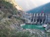
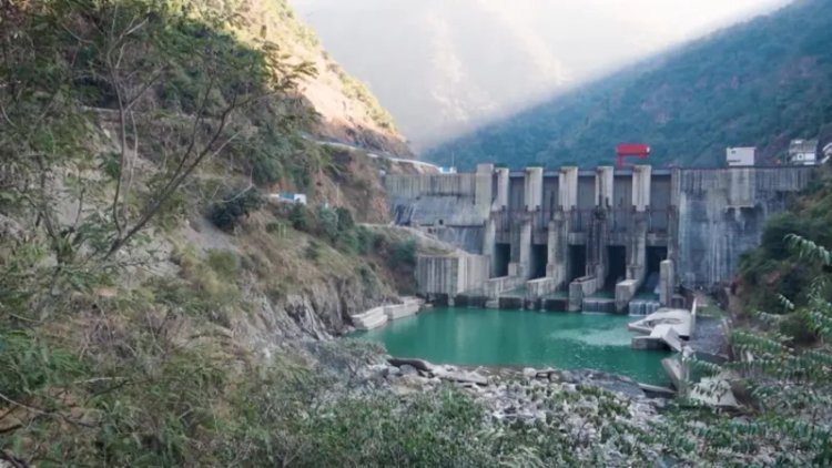
Lakhwar Dam Project
The Lakhwar Dam, a vital multipurpose hydroelectric and irrigation project on the Yamuna River in Uttarakhand, is poised to reshape regional water management and power generation. Globe View Technologies is proud to have successfully completed a comprehensive Topographical and Geospatial Survey in support of this nationally significant initiative. Our task covered high-precision drone and satellite-based mapping of the dam site and surrounding terrain — reaffirming our expertise in surveying complex Himalayan geographies.


Project Objective
The primary goal of the survey was to generate accurate topographical and geospatial data to support the detailed planning, structural engineering, and environmental analysis for the Lakhwar Dam and its associated components.
Our deliverables included:
-
High-resolution terrain mapping
-
Slope and elevation modeling
-
Identification of vulnerable zones (e.g., landslides, erosion)
-
Infrastructure impact mapping
-
Data to support environmental and structural planning
Scope of Work
Our detailed scope included:
• Drone-based Aerial Survey across the full project area
• Satellite Image Analysis for large-scale terrain evaluation
• DGPS-based Ground Control Point (GCP) Network Establishment
• Generation of Digital Elevation Models (DEMs) and Orthophotos
• Slope, land cover, and hydrological mapping
• Integration into CAD and GIS for design and review
Survey Area Overview
-
Location: Yamuna River Basin, Dehradun District, Uttarakhand
-
Key Components: Lakhwar Dam (204 m), Vyasi Dam, Hathiari Power Station, Katapathar Barrage
-
Terrain Features: Steep hills, river valleys, forest zones, landslide-prone slopes
Our Approach & Execution
Despite tough Himalayan terrain and weather variability, we delivered reliable and detailed survey data through cutting-edge methodologies:
✅ Drone Survey
We deployed high-resolution RTK/PPK drones with overlapping flight patterns to capture terrain across elevations, ridgelines, and valleys — critical for modeling dam impact zones and infrastructure.
✅ Satellite Imagery Integration
Multi-spectral satellite data complemented our aerial coverage, enabling us to analyze land use, water spread patterns, and terrain dynamics across seasonal shifts.
✅ Ground Control Network
We established a DGPS-verified GCP network to ensure sub-meter accuracy for all photogrammetric outputs.
✅ Photogrammetry & Modeling
Using industry-grade processing platforms, we developed:
-
Orthophotos
-
Contour Maps
-
Digital Terrain Models (DTMs) & Surface Models (DSMs)
-
Slope Analysis Maps
-
3D Visualizations
Deliverables Submitted
• High-resolution Orthophotos
• Detailed Contour & Topo Maps
• DEMs & DSMs for planning and simulation
• Slope and hazard zone analysis
• Data compatible with CAD & GIS platforms
• Reservoir impact maps and infrastructure overlays
Project Impact & Benefits
Informed Dam Design
Our precise elevation and slope maps guided optimal siting for dam structures, access roads, and safety infrastructure.
Risk Identification
By mapping landslide-prone zones and erosion-prone slopes, we provided key data for disaster mitigation and geotechnical planning.
Environmental Sensitivity
Our non-intrusive data collection methods reduced ecological disruption — vital for a region with rich biodiversity and vulnerable habitats.
Interstate Planning & Transparency
With six states depending on the Lakhwar project, our GIS-based outputs support transparent coordination across stakeholder governments and planning bodies.
Conclusion
Surveying for the Lakhwar Dam project was a technically challenging yet strategically rewarding mission. Our team overcame altitude, terrain, and weather barriers to deliver a rich geospatial dataset that will support one of India's most ambitious hydro-infrastructure ventures.
We thank our client for their trust and reaffirm our commitment to delivering high-accuracy, future-ready surveying services for national development.
What's Your Reaction?