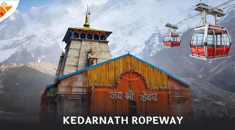
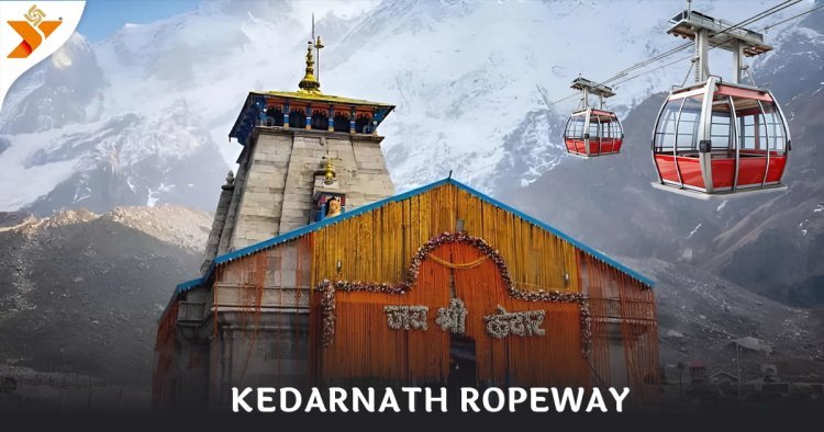
Drone Survey for Kedarnath Ropeway Development
Elevating Pilgrimage: Our Completed Survey for the Kedarnath Dham Ropeway Project. The Kedarnath Dham Ropeway is set to become a transformational link between Sonprayag and Kedarnath, dramatically reducing travel time for lakhs of pilgrims. As part of this prestigious project by NHLML (National Highways Logistics Management Limited), our company was entrusted with conducting the Topographical Survey using Drone and Satellite Imagery — and we’re proud to announce its successful completion. This challenging assignment across steep Himalayan terrain reaffirmed our technical capabilities, precision, and dedication to nation-building infrastructure.
Project Objective
The objective of the survey was to generate high-resolution topographical data to support planning and design of the 9.7 km ropeway from Sonprayag to Kedarnath Temple. Our task was to deliver:
- Accurate terrain models
- Identification of optimal tower locations
- Data to support environmental and structural planning
Scope of Work
Our scope of work for NHLML included:
- Drone-based aerial survey over the proposed ropeway alignment
- Satellite image analysis for regional terrain understanding
- Establishment of Ground Control Points (GCPs) via DGPS
- Generation of Digital Elevation Models (DEMs) and Orthophotos
- Mapping of slope, vegetation, and elevation changes
- Preparation of design-ready topographical maps
Survey Area Overview
- Length of Ropeway Corridor: Approx. 9.7 km
- From: Sonprayag
- To: Kedarnath Temple
- Altitude Range: 1,900 m to 3,500+ m
- Terrain: Mountain slopes, glacial paths, forests, ridgelines
Our Approach & Execution
Despite extreme altitudes and weather unpredictability, we successfully completed the survey using a mix of advanced technologies and strategic planning.
✅ Drone Survey
We deployed RTK/PPK-enabled drones to capture high-resolution imagery over the full length of the proposed alignment. Multiple overlapping flight paths ensured complete coverage of slopes, ridges, and valleys.
✅ Satellite Imagery Integration
We incorporated multi-spectral satellite data to complement aerial visuals and assist in slope analysis, land cover classification, and terrain shadow mapping.
✅ Ground Control Point (GCP) Network
Our field teams installed DGPS-based GCPs across the accessible terrain to ensure centimeter-level accuracy for image geo-referencing.
✅ Photogrammetry & Data Processing
Using industry-leading photogrammetry software, we produced:
- Orthophotos
- Contour maps
- DTMs and DSMs
- 3D terrain models
All outputs were quality-checked and delivered in CAD and GIS-compatible formats.
Deliverables Submitted to NHLML
- High-resolution Orthophoto maps
- Topographical maps with elevation contours
- Digital Terrain Models (DTM) / Surface Models (DSM)
- Slope maps and 3D terrain profiles
- Recommended tower location zones
- Export-ready formats for design and engineering consultants
Project Impact & Benefits
1. Enabling Safe & Efficient Ropeway Design
Our accurate terrain mapping helped determine feasible alignments and tower placements — critical to safety and functionality in high-altitude environments.
2. Minimal Environmental Disturbance
The non-intrusive nature of our drone and satellite methods helped maintain the ecological and spiritual sanctity of the Kedarnath corridor.
3. Time & Cost Savings
By reducing the need for extensive ground surveys, we helped compress timelines, lower costs, and speed up planning for one of India’s most high-impact ropeway projects.
4. Supporting National & Religious Connectivity
The Kedarnath Dham Ropeway is part of India’s broader push to improve Char Dham accessibility. Our survey contributed directly to making this vision a reality.
Conclusion
Successfully completing the topographical survey for the Kedarnath Ropeway stands as a proud achievement for our team. Despite the altitude, terrain, and weather challenges, we delivered accurate, high-quality geospatial data that will serve as the bedrock for engineering, safety, and environmental planning of this iconic ropeway.
We thank NHLML for trusting us with this critical responsibility and reaffirm our commitment to delivering world-class geospatial services for projects of national importance.
What's Your Reaction?