Drone Technology in Disaster Management : Dharali Flash Flood
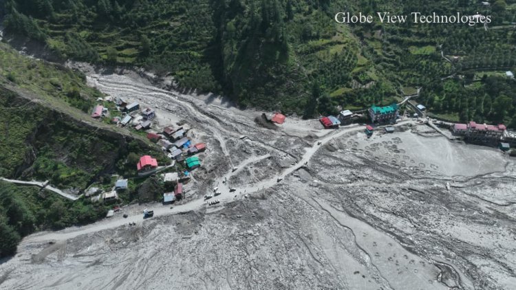
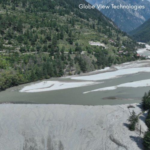
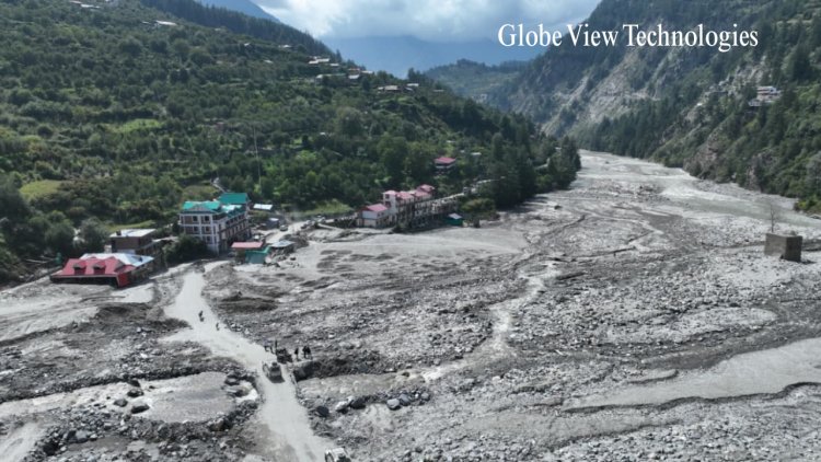
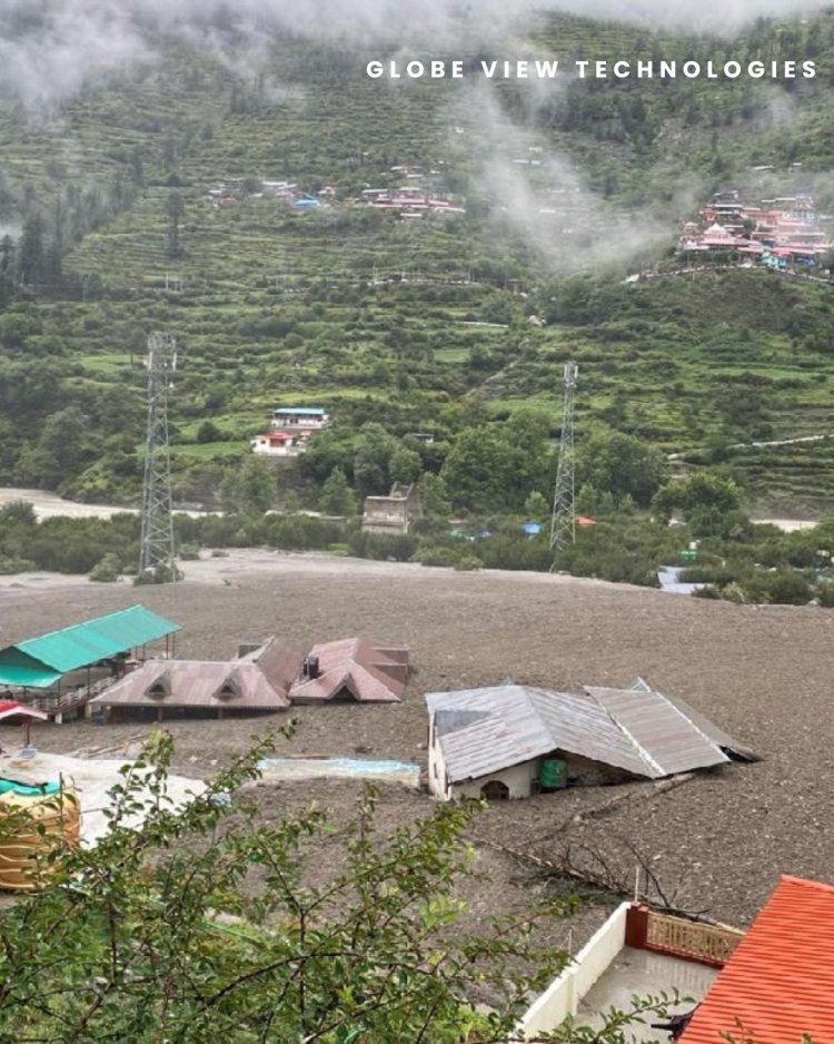
Globe View Technologies Pvt Ltd contributed to the relief efforts in Dharali by conducting a comprehensive topographical survey of the flood-affected area. We are proud to have contributed to the recovery efforts by conducting a comprehensive topographical survey of the affected area, as part of our larger project from Gangotri to Chinyalisaur.
Project Objective
The primary goal of this project was to generate accurate, high-resolution topographical and geospatial data of the Dharali region post-flash flood, enabling:
-
Identification of debris flow paths and flood-affected zones.
-
Detailed elevation and slope modeling.
-
Assessment of vulnerable areas prone to landslides and erosion.
-
Data-driven support for flood mitigation and disaster management strategies.
-
Assistance in planning resilient and sustainable rebuilding of infrastructure and communities.
Scope of Work
Our detailed survey work included:
-
Drone-based aerial surveys covering the affected and surrounding areas.
-
Satellite imagery analysis to complement aerial data and assess large-scale terrain changes.
-
Creation of Digital Elevation Models (DEMs), orthophotos, and contour maps.
-
Slope, land cover, and hydrological mapping to assess risk factors.
-
Integration of all geospatial data into CAD and GIS platforms for detailed analysis and planning.
Survey Area Overview
-
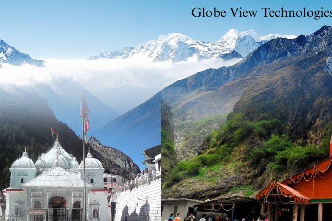
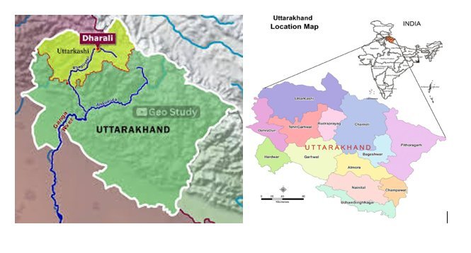
Location: Dharali region, extending from Chinyalisaur to Gangotri, Uttarakhand.
-
Terrain Features: Mountainous landscapes with steep slopes, river valleys, forested zones, and landslide-prone areas.
-
Project Significance: Critical for disaster recovery and enhancing flood resilience in sensitive Himalayan ecosystems.
Our Approach & Execution
Despite challenging terrain and weather conditions typical of the Himalayan region, our team deployed advanced methodologies to ensure reliable and comprehensive data collection:
-
Drone Surveys: High-resolution RTK/PPK drones were used to capture detailed images and terrain data, enabling accurate modeling of debris flow and flood impact zones.
-
Satellite Imagery: Multi-spectral satellite data helped analyze changes in land use and water patterns before and after the flood event.
-
Photogrammetry & Modeling: We produced orthophotos, slope analysis maps, and videography.
Deliverables Submitted
-
High-resolution orthophotos and detailed topographic maps.
-
Slope and hazard zone identification maps.
-
Data compatible with CAD and GIS software for integration into planning workflows.
-
Reports pinpointing debris flow routes and vulnerable zones.
Project Impact & Benefits
-
Informed Recovery Planning: Precise topographical data guided local authorities in identifying affected zones and prioritizing recovery efforts.
-
Risk Mitigation: Early identification of landslide and erosion-prone areas supports future disaster preparedness and mitigation plans.
-
Sustainable Reconstruction: Data-driven insights enable safer infrastructure design and community rebuilding with resilience to future floods.
-
Environmental Sensitivity: Non-intrusive data collection minimized ecological disturbance, preserving Uttarakhand’s fragile mountain ecosystems.
Conclusion
The Dharali flash flood survey project was a technically demanding but highly impactful assignment for Globe View Technologies. Overcoming the challenges of rugged Himalayan terrain and unpredictable weather, our team delivered precise and actionable geospatial data that will be instrumental in safeguarding mountain communities and fostering sustainable development.
We thank our partners and local authorities for their trust and look forward to continuing our mission of leveraging technology for disaster resilience and regional development.
What's Your Reaction?